The following is a selection of highlights from open-source investigations and in-depth reporting using various methodologies; from data mapping and satellite imagery to social media scraping.
Who is Ricardo Margo?: (2025) for The Longview News-Journal

The company used to purchase Ricardo Magro's Gulfstream jet, Aerium Enterprises, has had just two authorized members since its formation in 2021: J. Global Energy and Ricardo Magro, according to business filings with the Florida and Texas secretaries of state. Using Aerium's Federal Aviation Administration registry documents, the News-Journal was able to obtain the plane's N-number — basically its license plate — making it possible to track each flight since the plane was purchased. This flight in Nov. 28, 2022, captures one of many trips from Miami, where Magro lives, to Houston, where J. Global Energy's headquarters are based.
Background: Ricardo Magro, a Brazilian businessman and the country’s most prolific tax evader, purchased the Longview Gas Plant in 2020, which is located deep in the woods of East Texas. In late 2024, Sao Paulo police launched a large-scale operation against Magro’s Brazilian businesses, suspecting him of laundering money for the country’s largest drug cartel.
I led a six-month investigative project for the Longview News-Journal to verify the clandestine purchase in Texas by his family’s company, J. Global Energy, and claims by employees that safety issues at the Longview plant presented a serious risk to the surrounding community.
In the process of reporting the series, I collected dozens of business filings for review by a forensic auditor, located and tracked Magro’s personal jet, and detailed a deadly plant fire and allegations of an oil spill cover up, among other incidents. I worked with two Brazilian investigative journalists to obtain an internal Sao Paulo police memo detailing the law enforcement evidence linking Magro to Brazilian drug traffickers.

One of the U.S.-based companies under the J. Global Energy umbrella, Minefficiency LLC, a crypto currency mining operation in McAlester, Oklahoma, listed a non-existent corporate street address in San Francisco on its website and presented stock photos of an office as if they were a company-owned facility. (Archived screenshot/Minefficiency)
However, the gas plant wasn’t the only U.S. based business set up by J. Global Energy. Magro also established a crypto mining operation in McAlester, OK called Minefficiency LLC. Using reverse image search tools, I found that the website used stock images of offices to falsely advertise a Minefficiency office space in San Francisco, CA, which does not exist.
The East Texas Lithium Race: (2024) for The Longview News-Journal

Background: While East Texas was built by oil in the early 20th century, mining companies, local politicians and even scientists believe lithium, the key ingredient to nearly all electric batteries, will be the cash cow of the 21st — and that the mother load lies beneath the Piney Woods.
The highest lithium concentrations in North America were found in Cass and Franklin County in 2023. Companies have rushed to lock down mineral leases with the hope of striking it rich, but legal and environmental questions remain as the industry races to extract the mineral.
Lake Powell Shrinkage: (2023) for High Country News

Methane imaging from space: Nord Stream 2 pipeline rupture (2022):

Background: Before the Ukraine-Russian conflict, the Nord Stream 1 and 2 pipelines served as key energy conduits between Europe and the Western Siberian gas fields of Bovanenkovo. In late September, portions of the lines below the Baltic Sea violently ruptured, spewing an estimated 300,000 tons of methane into the atmosphere — the cause of the ruptures, or if the severing was an act of sabotage, is still unknown. Regardless of the geo-political consequences, methane is a powerful greenhouse gas and the quantity expelled in the days following the explosion would rank these leaks as the largest single release of methane in history.
Method: In the three days following the pipeline breach, the Baltic Sea was occluded by thick clouds making a satellite image impossible. Twice a day I would check Sentinel Hub, an open-source platform for satellite data, to see if one of the orbiting platforms managed to pass over the area of the breach during a gap in the weather. One September 30th, the European Space Agency’s Sentinel 2 satellite finally got a clear shot. I selected for short-wave infrared bands which have been shown by researchers to effectively locate methane plumes, discovering the southern-most breach shortly after (above image). While two separate research teams with access to higher resolution commercial satellites beat me to the shot a few hours before, this was among the first captures made with publicly available open source tools.
Mapping K.P. Kauffman oil spills in Colorado (2022):
The Denver based petroleum company has been in hot water with state regulators after a persistent pattern of negligence and a long history of spills. In order to produce this searchable map, I obtained a spill dataset from the Colorado Oil and Gas Conservation Commission (COGCC), then extracted the spills by operator (company). The final KML dataset was then imported into Google MyMaps, providing a searchable interface containing each incident related to KP Kauffman and the inspector notes from the site survey.
PART 1: Corporate influence campaign, Louisville, CO (2022):
Since 2020, The Denver-based property developer Brue Baukal Capital Partners has been seeking to transform the former Storage Tech campus off of US 36 into a new commercial complex called Redtail Ridge. By March of 2022, complaints from local residents that the developer was doing little to set aside open space or prioritize sustainability, hardened into an organized grass-roots campaign seeking changes to the site plan. What was less predictable was that Brue Baukal would opt to funnel large sums of money to influence Louisville, a city of 20,000 people.
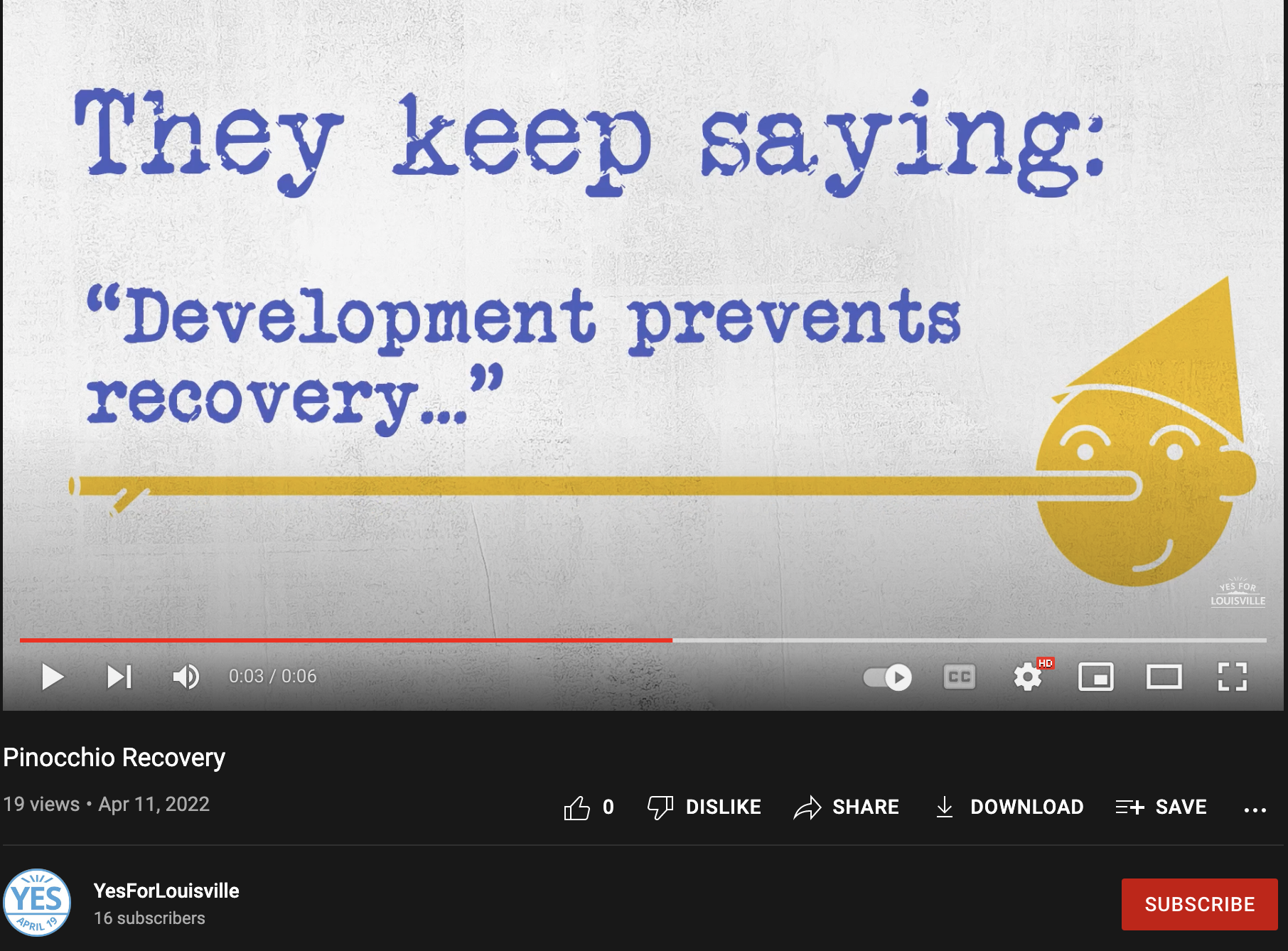

Through a nonprofit shell group called “Yes for Louisville,” registered early in the year, Louisville residents became inundated with attack ads (Image left). The right side image shows the dollars spent through Facebook to direct the content toward users. Roughly 90% of all funding or approximately 50-thousand-dollars provided to Yes For Louisville came from Brue Baukal Capital Partners. Local residents were outspent by a more than 10:1 ratio.
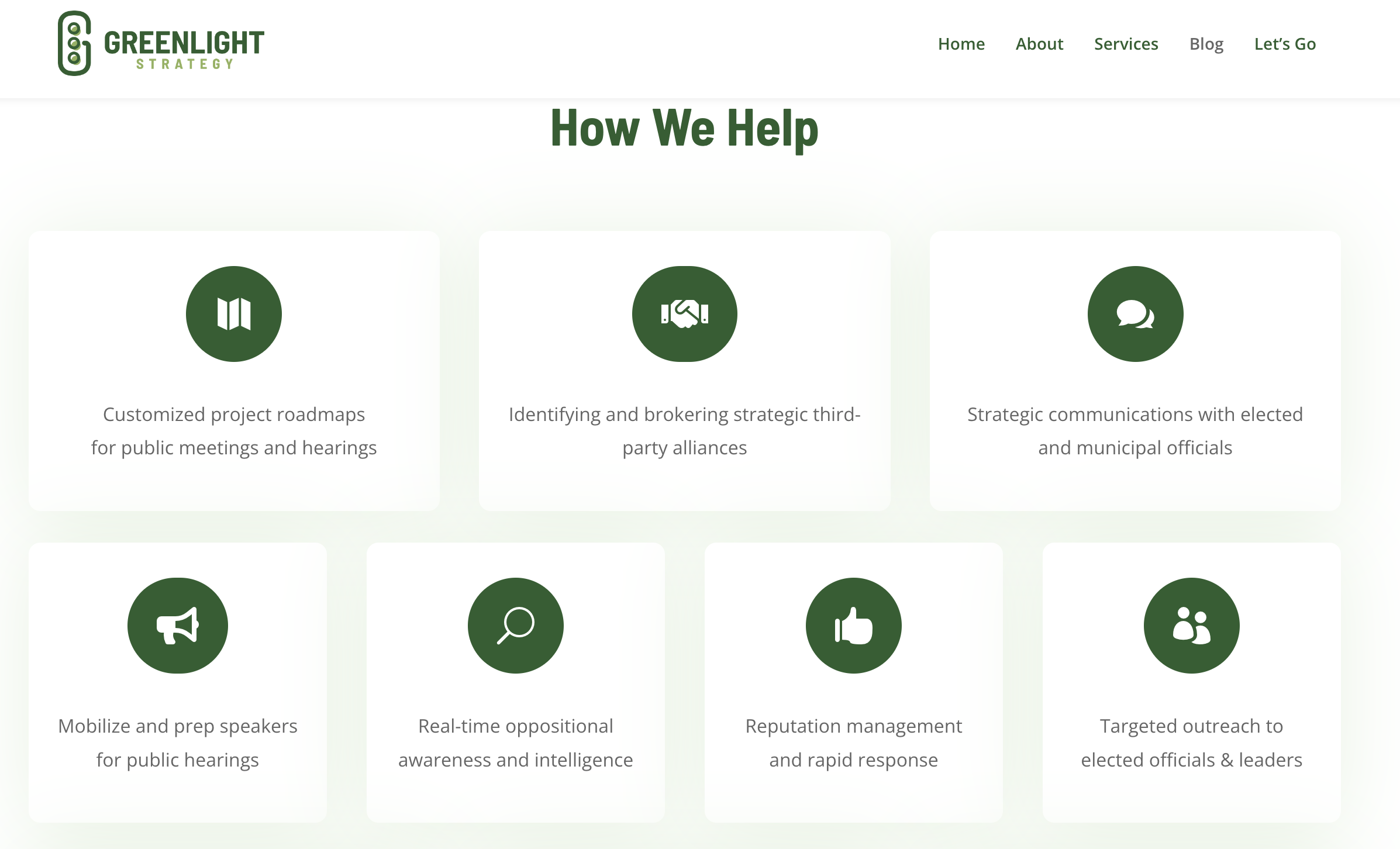

More than half of the corporate contributions made to Yes for Louisville were spent on two public relations firms, The Strategy Division based in New York, and Greenlight Strategy in Boulder, CO. According to Greenlight Strategy’s website, the company helps property developers push through contentious projects by offering “real-time oppositional awareness and intelligence,” “recruiting community leaders and members,” and cultivating strategic relationships with “elected officials,” among other services.
PART 2: Putting a face to an infamous dark money lawyer (2022):

The dark money lawyer Katie Kennedy was involved with the creation of the non-profit Yes For Louisville, which was financially backed by Brue Baukal Capital Partners according to files obtained from the Colorado Secretary of State.
Lawyer and registered agent Katie Kennedy has continued to be a mysterious force in Colorado politics. The attorney has helped set up over 80 special interest groups throughout Colorado for causes ranging from anti-homeless legislation in Denver, to pro-fracking initiatives in Erie. A list of her clients can be found through the state’s TRACER database. In early 2022, she became involved with Yes for Louisville, the interest group used to fund Redtail Ridge attack ads, flyers, and $35,000 in outside lobbying to squash local opposition to the build. These issue committees and nonprofits are registered to provide a legal conduit for vast quantities of money into local campaigns. Compared to the billions now lavished on swaying senate seats and presidential campaigns, it can cost less than $100,000 to overwhelm a municipal election or referendum.

Taken from the Sturm College of Law commencement video in 2009. These are the only known images of Katie (Katherine) Kennedy
To my knowledge, these are the only known images of the lawyer who has become synonymous with dark money campaigns throughout the state. I found Kennedy’s education records through Colorado’s list of registered agents and a corresponding record on the University of Denver’s website. Then I searched for the Sturm College of Law’s YouTube channel to see if commencements were recorded in full. Once I saw that they were, I pulled out the auto-transcription of the 2009 event generated by YouTube and found the 10-second portion of the 1-hour and 37-minute ceremony where Katherine A. Kennedy walks up to the stage to receive her diploma.
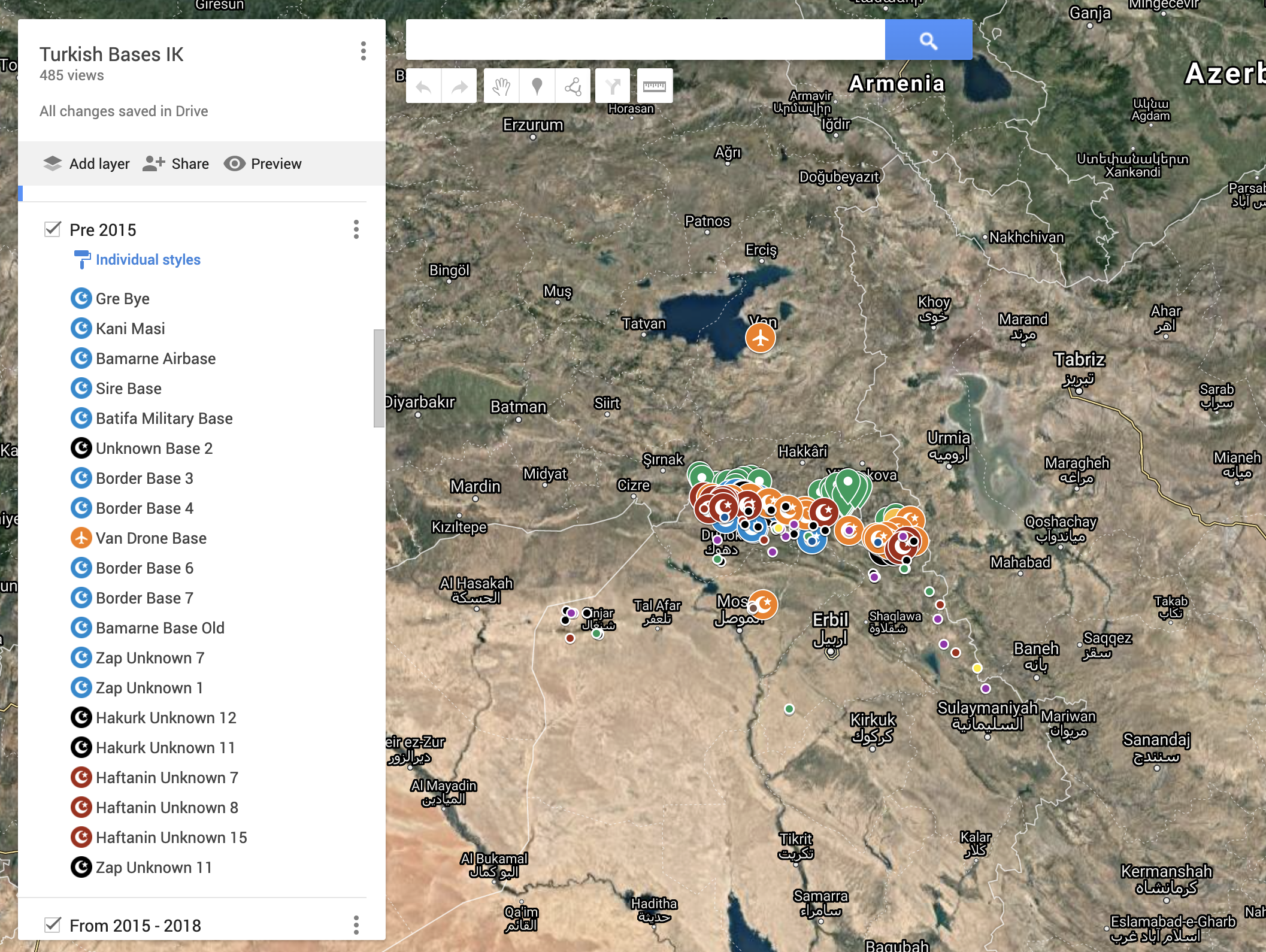
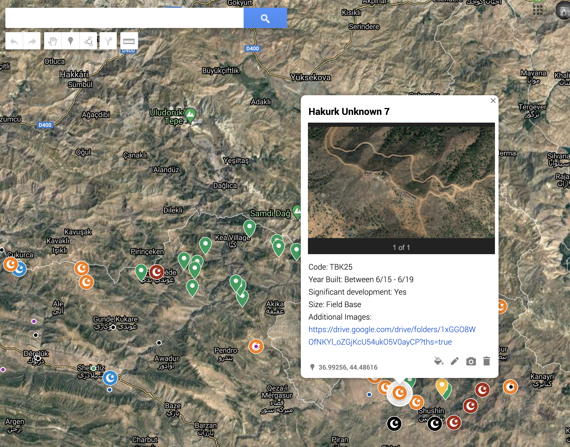
Geolocating Turkish bases/airstrikes in Iraqi Kurdistan (2021): For Airwars
During my time working with a civilian harm monitoring group based in London, I was tasked with finding Turkish bases implicated in attacks in Iraqi Kurdistan, using publically available satellite imagery. Our limitations on funding forced me to be resourceful, and I learned just how powerful programs like Sentinel Hub, World Imagery Wayback, and Open Street maps’ image aggregator can be for investigative journalists. With the exception of a single base, we were able to map out the entire region’s military footprint using open source programs exclusively.
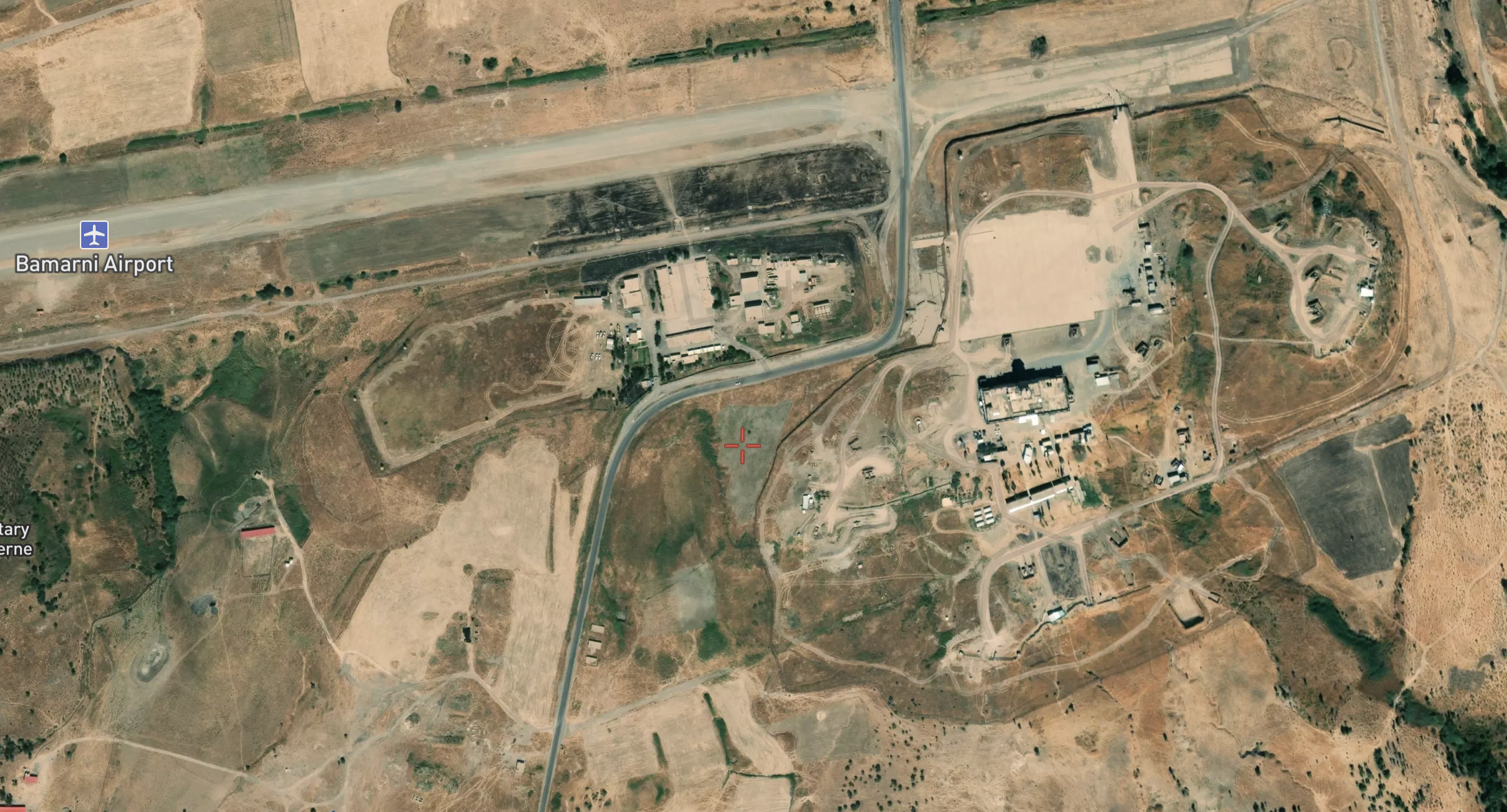
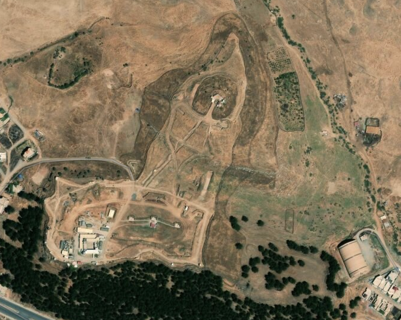
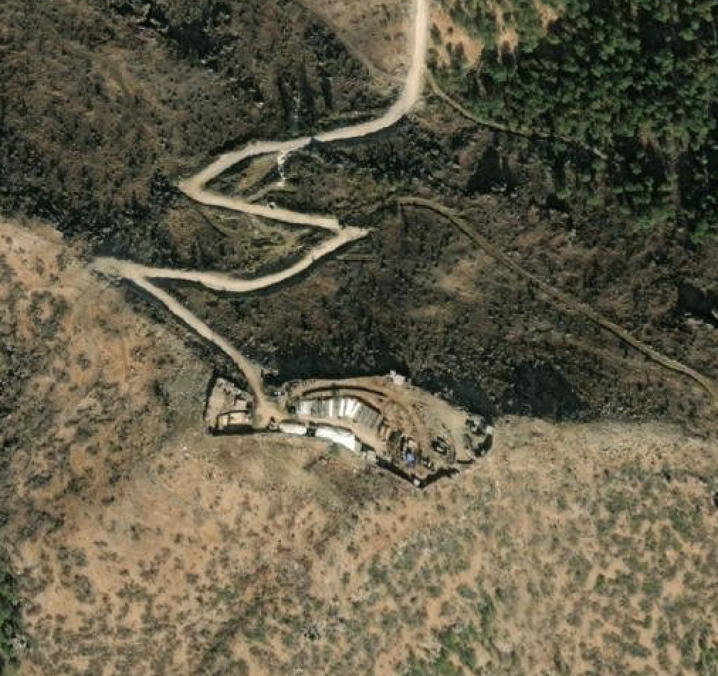
Once we collected enough images, I created a map in order to array the bases we found and combine them with five years of airstrike data. Our findings revealed a vastly expanded occupation as well as an increasing tempo of airstrikes over the past two years.
Legend: Strikes are small dots and bases are large dots color-coded according to date of construction (Red=newest, Blue=oldest). Green pins are suspected bases that cant be confirmed due to insufficient image resolution. Full article with major media partner forthcoming and therefore still images only.
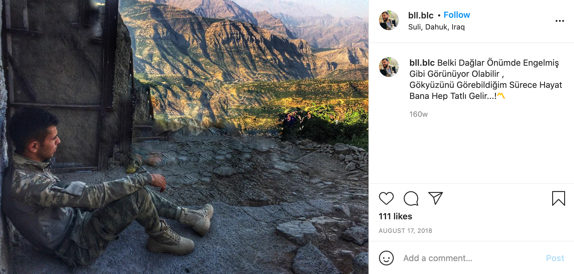
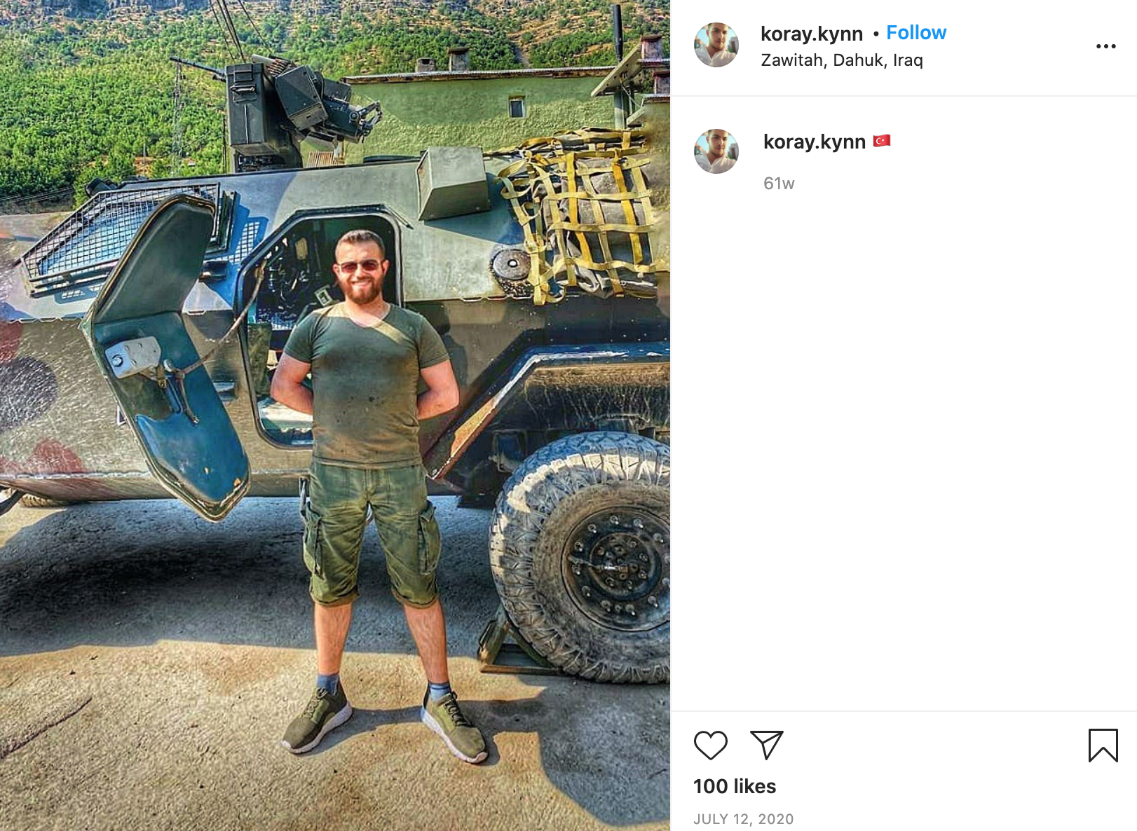
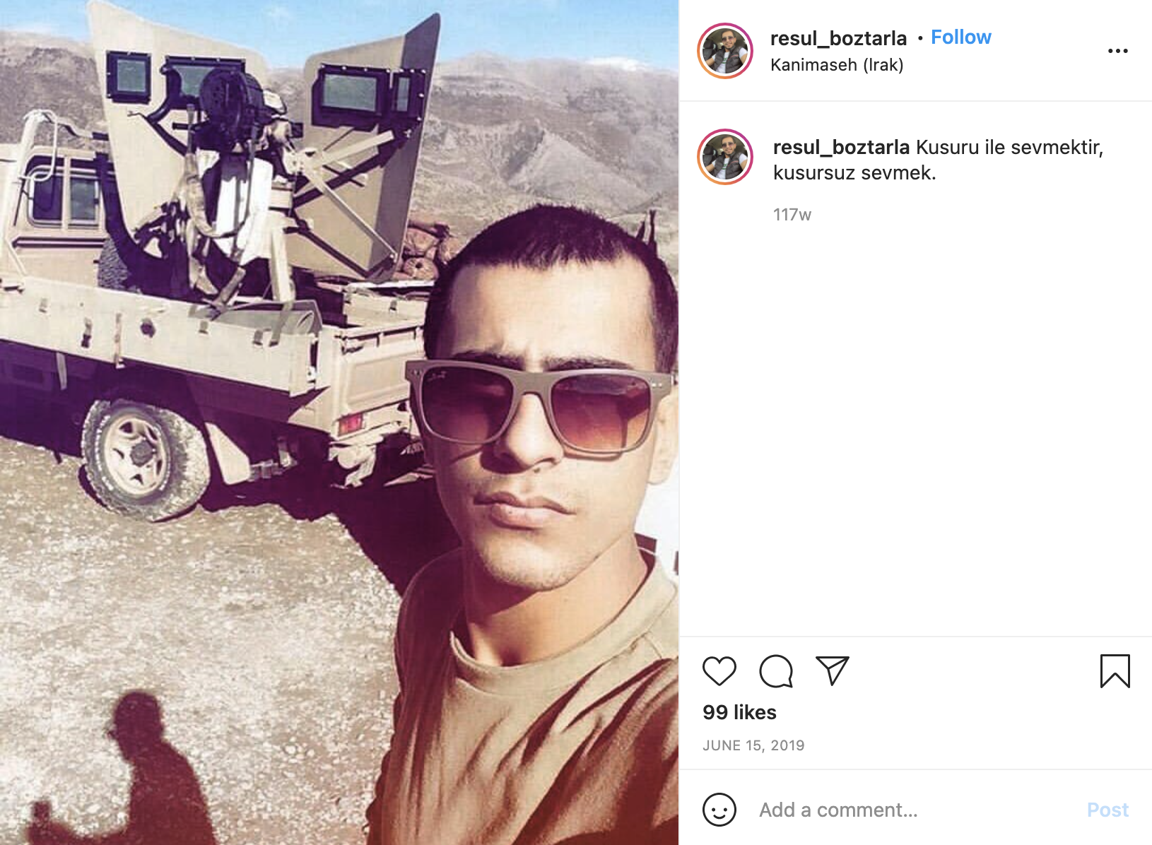
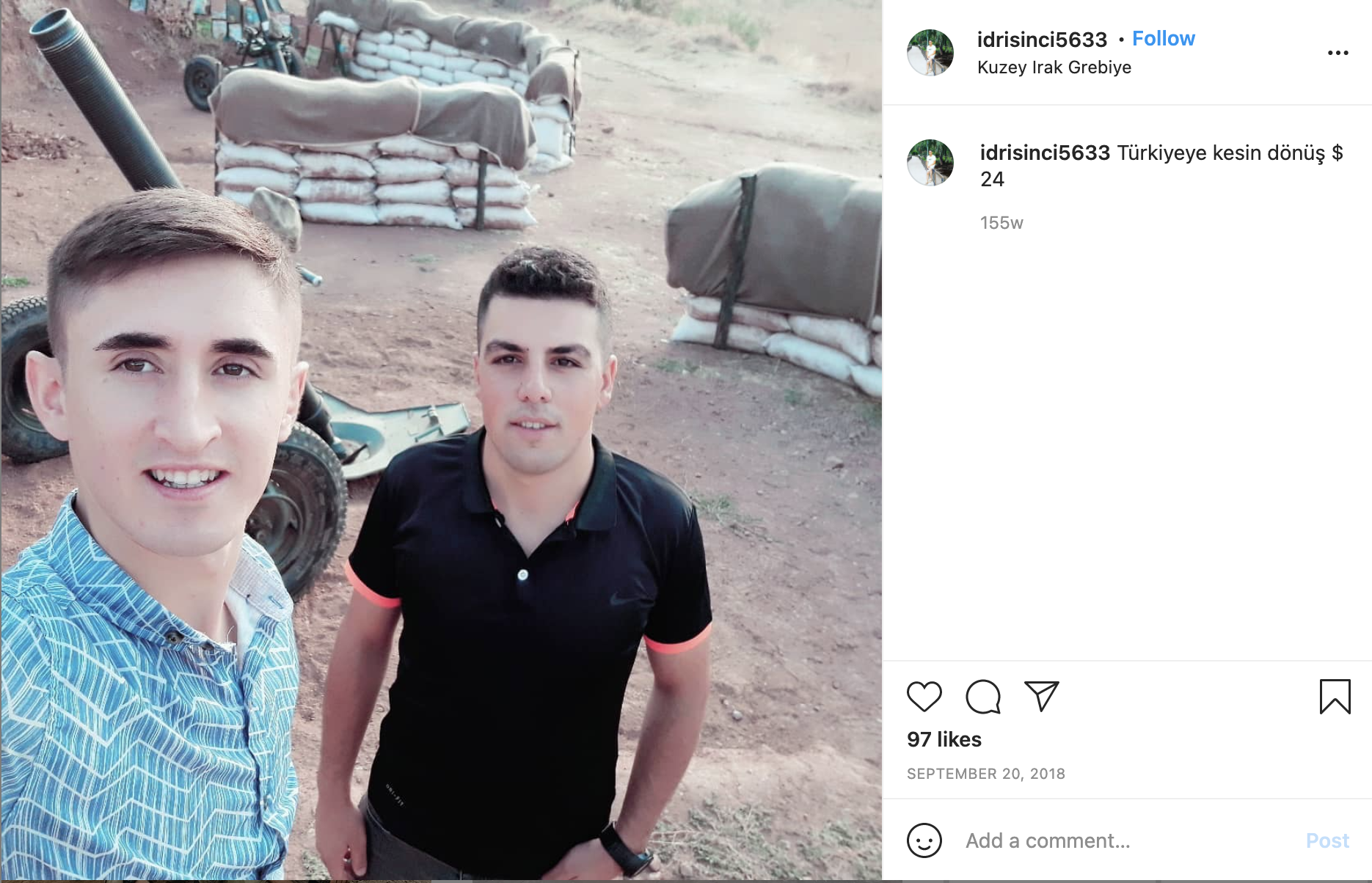
Scraping Instagram posts from remote military sites (2021):
While geospatial imagery is vital for monitoring remote and inaccessible sites, the evidence it provides can be incomplete. In order to better understand what was happening on the ground in Kurdistan, we employed a novel Instagram scraping tool created by Bellingcat. The tool exploited the location tagging function for posts and then allowed us to search for posts by coordinates. This meant we could see inside the bases from the perspective of the soldiers and confirm the presence of artillery.
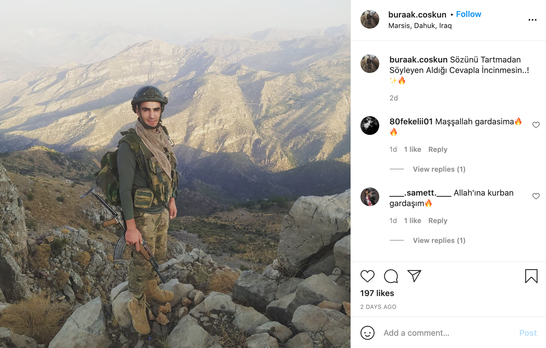
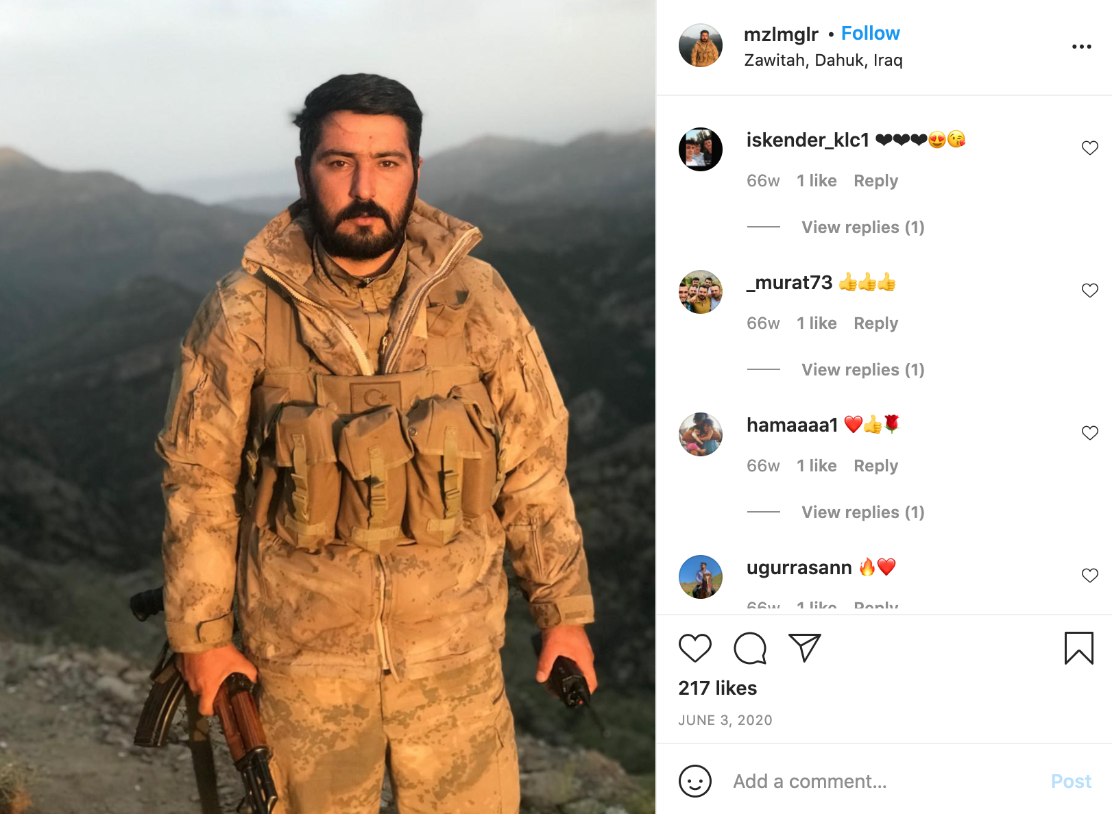
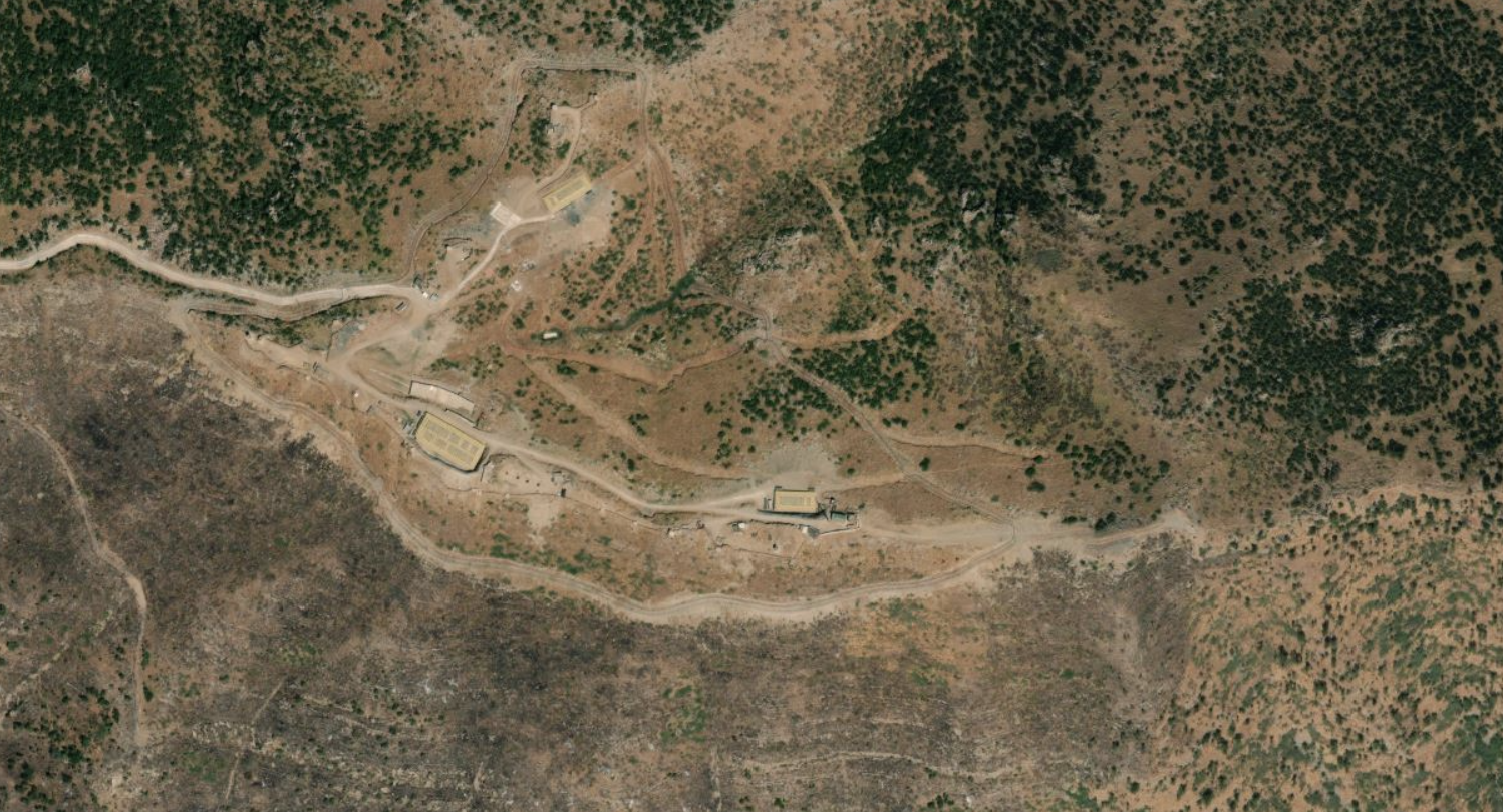
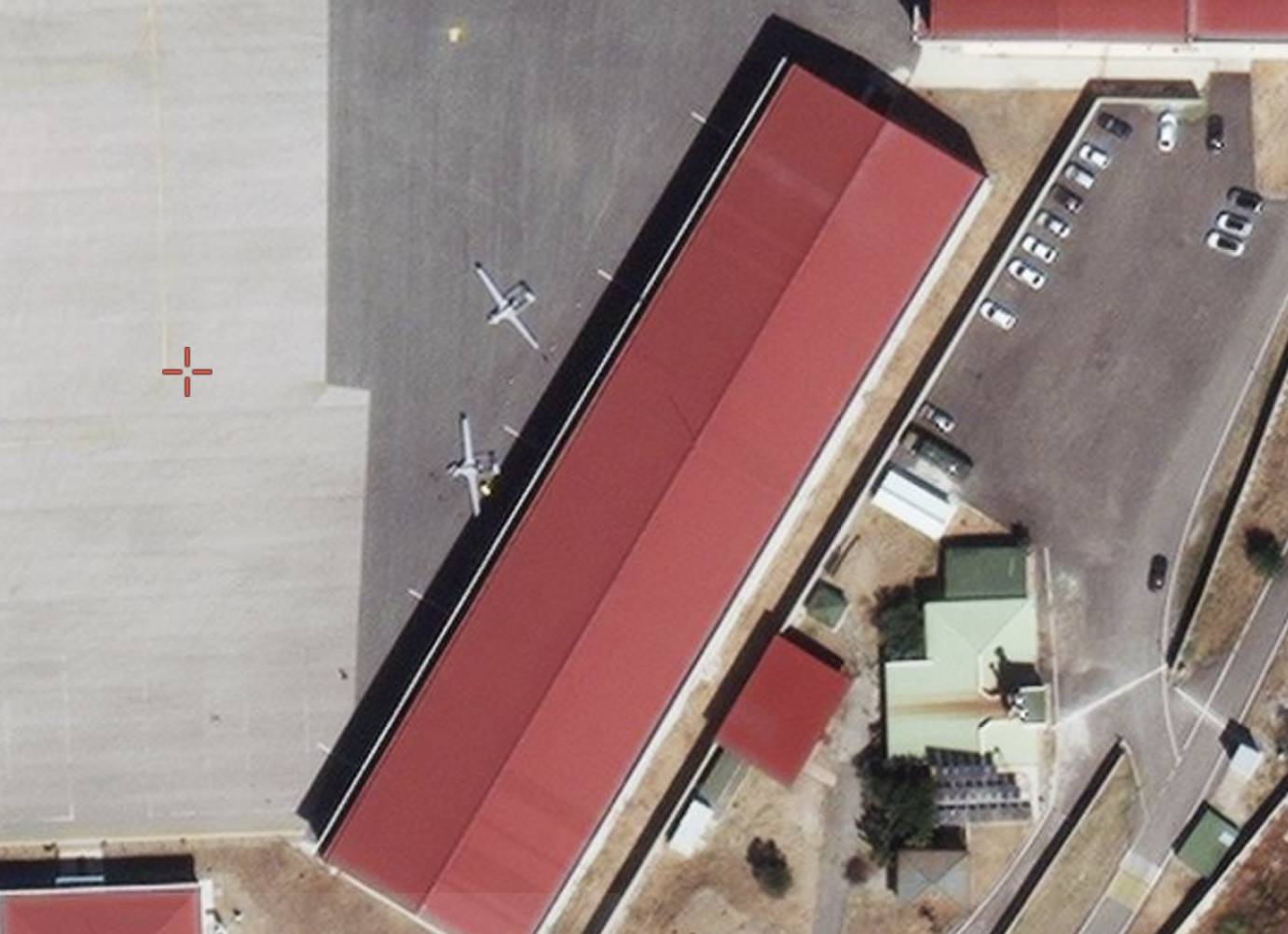
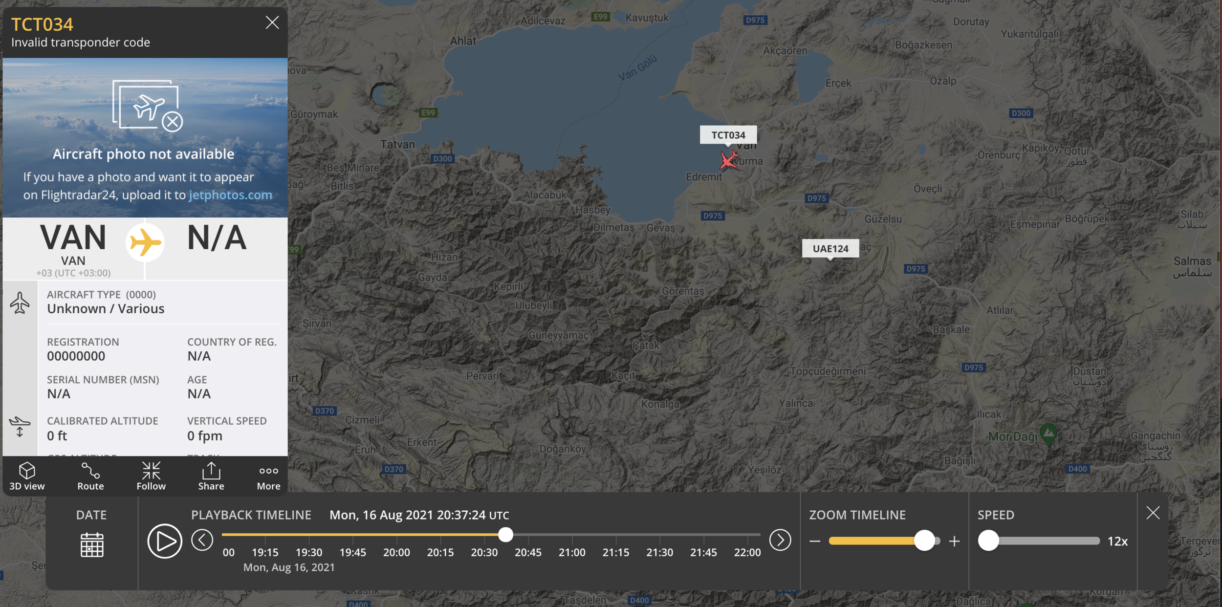
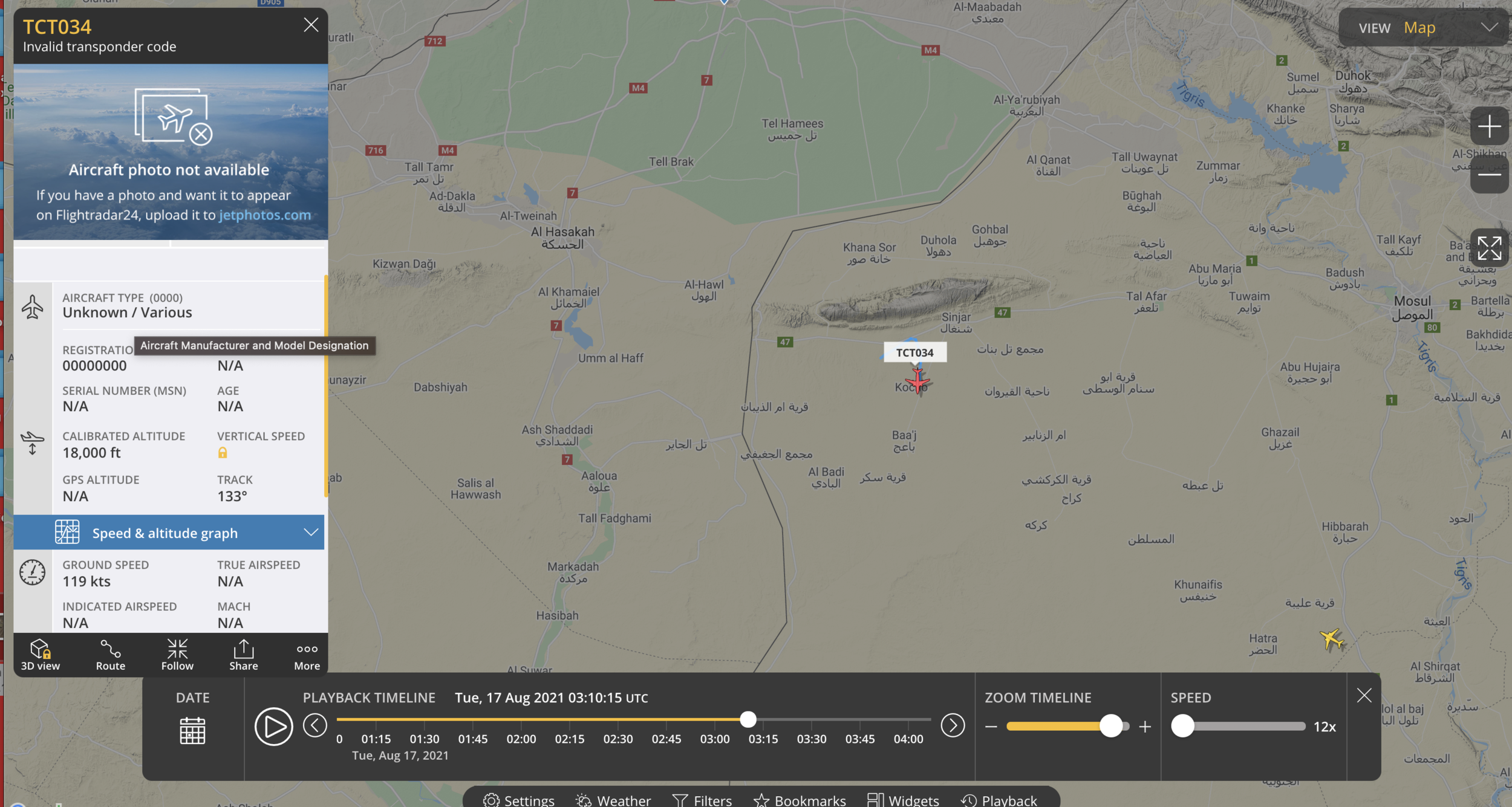
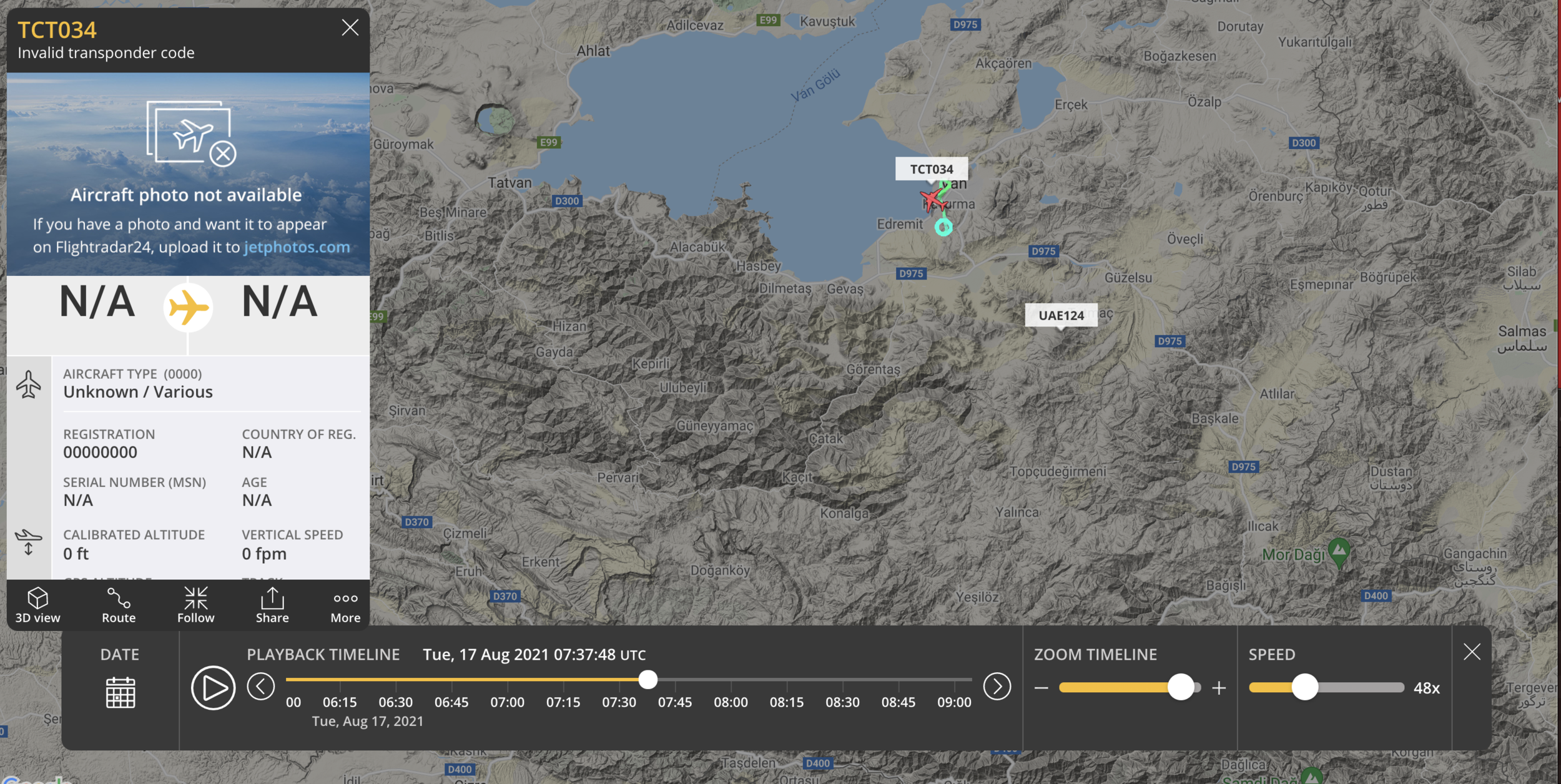
Discovery of Turkish military drone base, Van, Turkey (2021):
With a tip from Twitter (the Turkish air force call sign is “TCT”), I tracked what appeared to be a drone flying north from Iraq back to Van, Turkey on flight radar. It exhibited all the usual traits: circling perfectly for hours above a single location, unusually long flight durations, and low airspeeds consistent with those reported by aviation experts. I then searched for the most recent satellite imagery and to my amazement, found multiple Bayraktar II’s loitering in front of freshly built hangers. Finally, I inputted the coordinates for Van airbase into the Bellingcat tool, finding a Bakraktar II (killer drone) posted by the Turkish military police air wing and geolocated that photo to the site’s S. W. hanger.

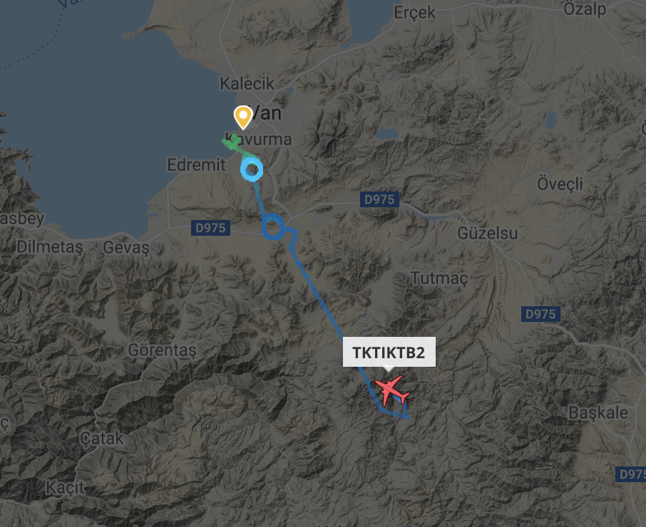
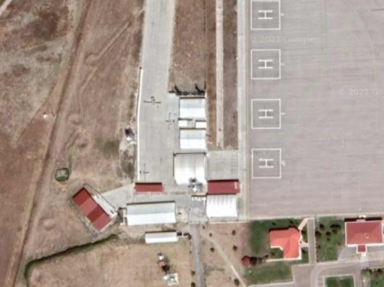
Incidentally, we also found that the Turkish airforce was pinging the exact drone model in some of the call signs instead of the generic “TCT” designation. TKTIKB2 refers to the Bayraktar II drone.
Business Improvement Districts, London Map: (2021) for East London Lines
The map below depicts Business Improvement Districts (BIDs) in London for a published investigation about their connection to extraordinary rates of Stop-and-Search police actions (the equivalent of Stop-and-Frisk policy in New York City). Data was taken from the London Data Store, a public access archive, and converted to GEOJSON to manipulate in Google MyMaps.
These districts are zones within a city where local businesses are given control of some municipal functions, from security to street cleaning, to save the local government money. These zones were then correlated with Stop-and-Search data provided by the Metropolitan police. My series was covered by the Network for Policing and Accountability.
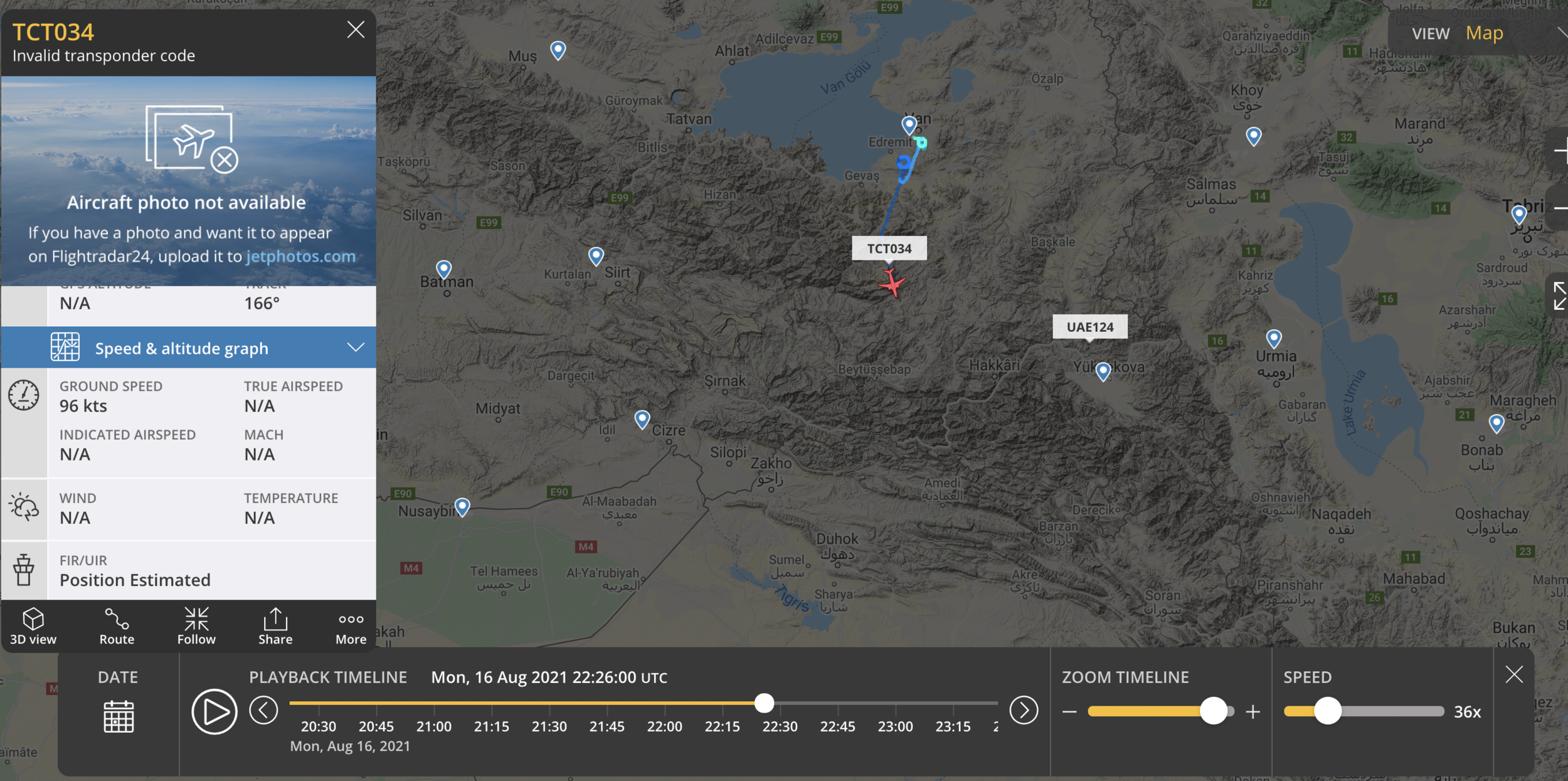
August 17th Sinjar hospital strike, patterns of drone operation (2021):
On August 17th, 2021, an alleged Turkish airstrike struck a Yazidi hospital in the village of Sikeniye killing eight, including four medical workers. Using FlightRadar24 I reconstructed the pre-strike reconnaissance over the village, tracking a Turkish drone flying from Van that later disappeared off flight radar and reappeared for half an hour over Shengal. The airstrike would come hours later that day.
Military road network construction to Turkish forward bases: (2021) for Airwars
Over time our team began noticing that a high-altitude road network preceded the construction of bases and indicated where to focus imaging resources to find the newest installations. I employed Sentinel Hub’s timelapse function, creating a GIF showing the road network growth towards bases overlooking Zaxo (Zakho), Iraq.

Hypergallery (2019):
The Hypergallery locative art project was inspired by six months spent living in Shanghai during college. In China, QR codes were ubiquitous long before COVID 19, when the scannable hyper-links saw mass adoption in the U.S. At the time of this project, QR codes were still foreign to most Americans. I wanted to explore the subversive potential of location-based media and came up with a handful of micro exhibits that activated once scanned by a phone. The two below examples are part of a larger set commissioned for the WKE art collection.

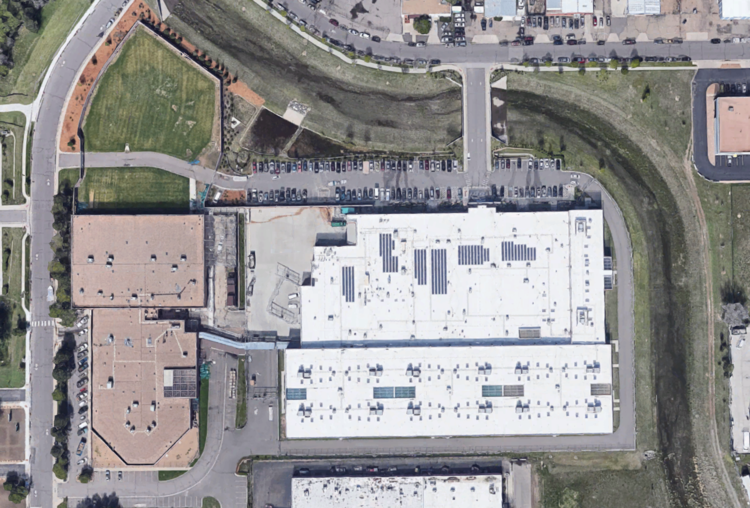
Samuel Shaw, Formation of an Amazon Fulfillment Center
QR Code on foam-backed mylar sheet, (9 in x 9 in)

Downloadable GIF: ESRI satellite data from DEN2 fulfillment center compressed into low-resolution slides

Samuel Shaw, Separation Wall, W. 63rd
QR Code on foam-backed mylar sheet, (9 in x 9 in)
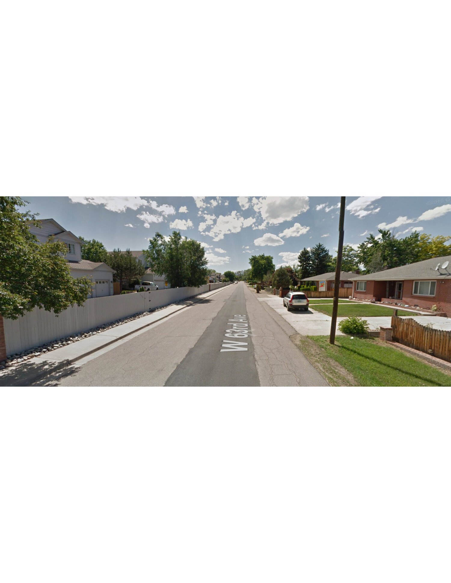
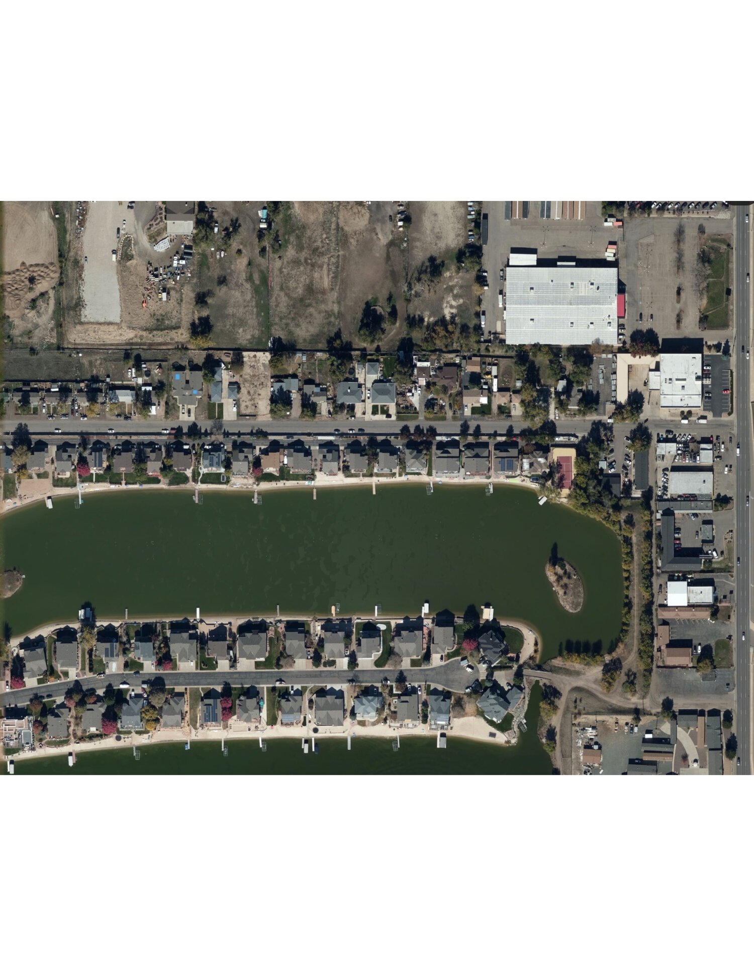
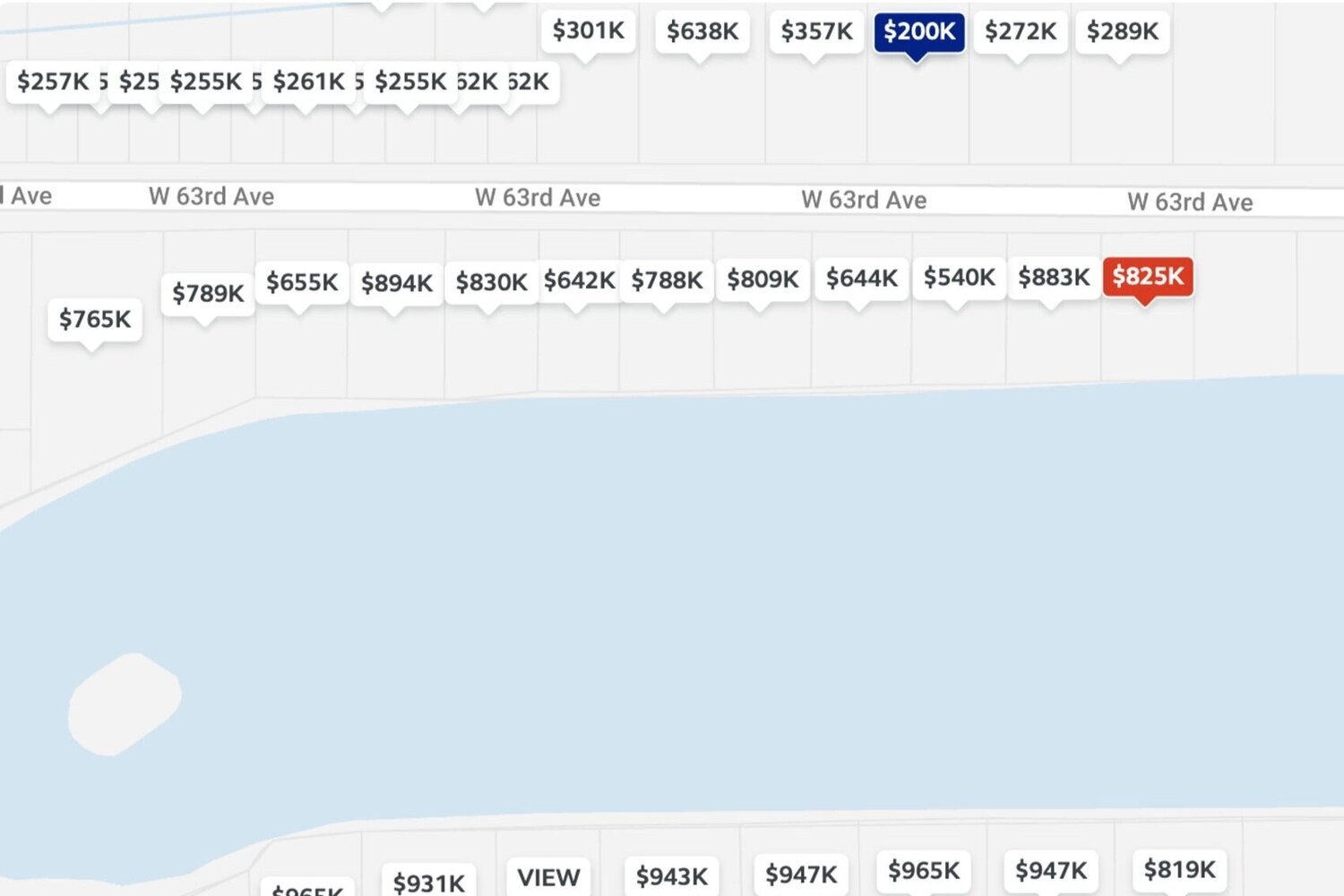
CLICK IMAGE TO SCROLL: Downloadable PDF packet: (1) Google Street View capture, (2) Satellite image capture, (3) Property value map
Colorado Prison Tour (2018):
The project, a survey of Colorado’s prison system for artist Ron Pollard’s website, WKE, was my first taste of how powerful geospatial techniques could be for journalists. The conceit was simple, image public and private penitentiaries throughout the state and combine those images with more traditional research and storytelling. Colorado Prison Tour was an important starting point for my introduction to open source investigation techniques. It is a part of a larger series of 13 entries.
Aurora Immigrant Detention Facility: (Privately Owned - GeoGroup)
Prison Population: 1,532
Notable Features/Incidents: Colorado has its very own for-profit immigrant detention center in Arvada (3130 Oakland St, Aurora, CO 80010). The facility is currently fighting a lawsuit alleging that over the last decade, some 60,000 detainees in GeoGroup’s care were subject to forced labor with no payment. At the Aurora detention facility, refusal to perform labor results in solitary confinement, a practice the Colorado Department of Corrections claims to disavow. The facility is unequivocally involved in President Trump’s policy of family separation according to investigations by the Colorado Independent. But perhaps worse are the conditions detainees face inside. A complaint filed by the American Immigration Council (AIC) found that “Medical and mental health care in immigration detention facilities—including Aurora—repeatedly has been flagged as grossly substandard, even though substantial evidence indicates that facility staff, and ICE, are aware of the grave risks to detainees’ health.” In December of 2017, just 15 days after being detained in Aurora, Kamyar Samimi died of cardiac arrest; this was the second death at the facility in six months.
Colorado State Penitentiary: (Publicly Owned)

Prison Population: 756
Notable Features/Incidents: Colorado State Penitentiary (CSP) is the primary execution site for death row inmates. It is also one of 11 prisons in the Cañon City/East Complex, the largest carceral archipelago in the state and at 7,600 inmates, one of the largest in the country. Cañon City is colloquially referred to as “Prison Valley” by residents.
Sterling Correctional Facility: (Publicly Owned)

Prison Population: 2,585
Notable Features/Incidents: Besides being the largest single prison facility in the state, Sterling Correctional has also paid the largest settlement in Colorado history. In March of 2018, Inmate Mitchell Mullen was awarded $6 million dollars after being paralyzed by a prison guard while suffering a seizure. Three Sterling Correctional officers are now facing charges after allegedly tricking three muslim inmates into praying in a cell which they had fumigated with tear gas.
Florence Correctional Complex/Sumo Golf Village: (Publicly Owned)

prison population: 1,500
Coordinates: 38.366519, -105.097468
By Samuel Shaw